Showing posts with label Fall 2010 Road Trip. Show all posts

Sunday, October 30, 2011

Heading Home

I left Yreka, CA behind after a joy-filled good bye with my auntie and headed North toward Salem, OR. Thankfully my headlights held tough while I drove through some pretty nasty, rainy weather. After driving around town several times due to my inaccurate interpretation of my friend Kim's directions, I finally made it to her house. We hung out with her roommates for a bit that evening and then talked fairly late, catching up on life and sharing our hopes for the future. it would be fair to say that Kim is going to go far in life because of her encouraging nature, commitment to others, and love for the people around her. I awoke that next morning for breakfast among new friends and headed off toward home on the final stretch of my journey.

The weather was holding well and I was on the home stretch. Minus the fact that I couldn't listen to the radio because the roar of my "hole-y" muffler was so loud, it was a good drive. I was initially worried about getting over the pass into Montana, but I got through early enough that the road surface hadn't froze yet. My final stop before making it back to Kalispell was in St. Regis, where I filled up on fuel, sunflower seeds, and my usual gas station coffee laced with hot chocolate. Unfortunately, my headlights would not turn on when I started my pickup and no amount of jiggling of wires, whispered coaxing words, or yelling harsh insults would get them to light my way home. Thus I spent my last night on the road sleeping in the back of my truck in the parking lot of the Travel Center listening to country music blaring from the loud speaker. Home was so close I could feel it, and all I could do was wait for the light of the morning.

I woke up before sunrise the next morning and drowned my disappointment in some huckleberry pancakes. Then I made the final slog home. And what a Home-Coming! The valley had gotten some early season snow and I was able to head up to the ski resort after Dad got off work to hike the mountain with some friends and get in the first turns of the season. If my trip around the West had been a giant sundae, then skiing the day I got home was a giant cherry on top!

-----------------------------------------------------------------------------------------------------------------------------

As I sit here and write this final post almost a year since I made the journey, I can't help but reflect on how amazing this experience it was. I feel extremely lucky to have been able to take the time off of work and school to visit beautiful natural sights and wonders that I had been curious about for some time. I drove a lot of miles to hike in deep canyons, ponder big trees, scale beautiful granite rock, and ride technical slickrock. It has proved to be a sort of "sampler trip:" I hit the hot spots and didn't spend too much time in any one particular area, but I know places that I want to travel back to and spend a longer period of time exploring.

As fun as hiking, running, climbing, and riding is beautiful places is, I don't think it would have been the same without all the special people that I was able to visit along the way. It has reminded me of the importance of involving other people in my adventures and to use life experiences to build lasting relationships with those whom with I travel through life. My hope is to grow from this great adventure; to let the miles of  this road trip work on me and mold me into a better person.

Saturday, October 29, 2011

Green Wine Country, Deep Blue Ocean, and White Mountains: Adventures in Northern California

Ocean in view: Oh the Joy!
The morning after arriving at my Aunt and Uncle's house continued to be special. I was treated like a prince and it was as if my arrival made the world stand still and should have been called a national holiday! We had a wonderful breakfast, Luke skipped his first class at the High School , and I went with the four of them to drop both Luke and Hope off at school. Then I spent the morning with Craig fiddling with the lights on my pickup before scooting further north to see a good friend from College.

Lil' Champ and I rolled into Potter Valley feeling somewhat out of place. I  immediately felt like this sleepy little town was a place you could go to escape the hustle and bustle of everyday life, which might be a good description of what my friend Amanda had done. We met up at her house and scurried off to the foothills to ramble among the green grasses and damp earth of autumn in California. We followed truck trails, cow trails, deer trails, and no trails, climbing up to a gorgeous viewpoint of the town below, all the while having the kind of warm, friendly, and open conversation that I have come to crave from my friends. Amanda jumps up on this boulder at one point and declares to me and the world that she had planted a meadow full of wild flowers and hoped to see them sprout in the coming spring. She's so fun! After the "ramble," the rest of the evening with filled with lab puppies, wonderful homemade food and wine with Amanda's sister, and even deeper conversation.

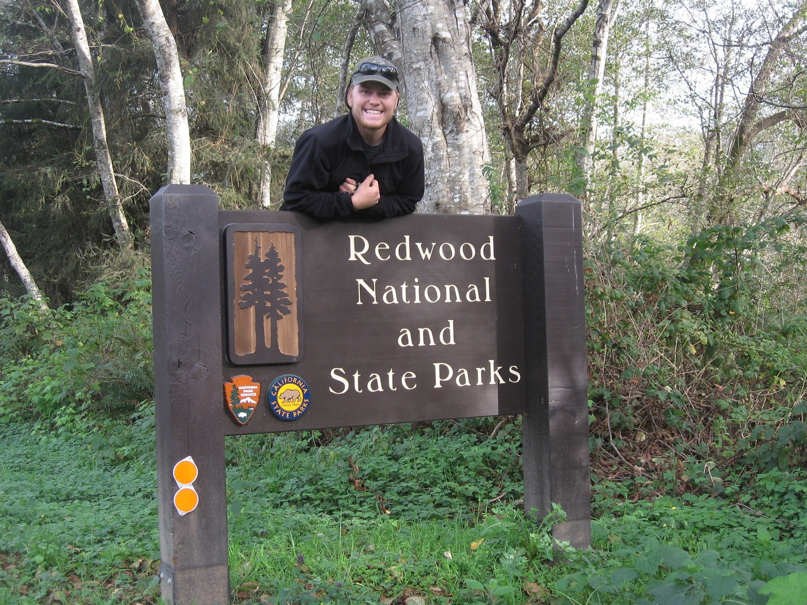
The next morning, after some not-quite-tearful goodbyes, I continued my journey around the West by driving west to the coast. I wandered up the coastal highway through amazingly beautiful country, eventually finding my way to the Redwoods National Park (RNP), the 12th National Park of my trip. Earlier, in Southern California, I stopped by the Sequoia National Park and saw the biggest trees of my life. It is my understanding that Sequoias are an inland variation of the Coastal Redwoods found in Northern California in Humboldt State Park and the RNP. If the Sequoias are the largest trees in the world by shear bulk, the Redwoods certainly give any other species a run for their money in a "tallest tree" contest.
National Park number 12 of my trip: the Redwoods.
The woods of the RNP are almost rainforest-like compared to the forests back home in Montana. Green is the primary color with life exploding all around you in the form of grass, moss, ferns, and the like. And I even got to see wildlife. This trip coming on the tails of a somewhat frustrating archery season chasing elk, I have a mix of emotions seeing the wily wapiti in the Yellowstone and Grand Teton areas, and now in the Redwoods. It is a remarkably freeing feeling when I can witness elk in their native habitat and appreciate them for what they are: a beautiful creature of the forest, strong and powerful, and masters of survival, without the pressure of the harvest that hunting usually brings. It is definitely a different enjoyment, but one that I could come to appreciate.
That's me, and yes, I'm hugging a tree. A really big tree.
Evidently the elk are rather ferocious in Northern
California...and they know it! The sign says "Wild Elk:
Do not approach or Feed."
Epic self-timer photo. Took me a couple of takes. But
isn't that sunset beautiful?
If you continue through the Park toward Crescent City, you'll come to the ocean and I happened to do just that as the sun was setting. It was gorgeous! Being a mountain boy from land-locked Montana I don't get to see the ocean very much, which made this that much more enjoyable. There is something about the sea that sparks the imagination and gives joy to the spirit; a view to the horizon, a salty breeze, and foamy waves crashing on the shore makes one believe they can do anything.

I enjoyed the sunset until the light no longer painted the sky with color and drove North through Crescent City, "around the horn" through Grants Pass, Medford, and back down to visit my Auntie Ingrid and Uncle Mike. Once again, I cannot express the gratitude that I  have for such a wonderful loving family scattered across the country. My aunt and uncle welcomed me into their home with some great food and even better conversation. The only thing that ended our time together that first night was my "glazed look." I had been on the road all day and was falling asleep in my chair. I hope that Uncle Mike will find a way to forgive me; it was because I was tired and not because of his pontifications that were making my eyes droopy.
Looking up the standard climbers' route of Shasta with
the alpine climbers' cabin in the foreground. 
Yet another coincidence on my trip increased the enjoyment factor exponentially: Ingrid happened to have the day off of work the next day. She took me on a tour to see Mt. Shasta and hike around at its base. There was a lot of snow around and we had some fun route finding among the fresh smelling pine trees in the crisp autumn air of the volcanic highlands. There is something about fresh air, hiking and snacky-food that stimulates the mind, body, and spirit, but then again I just love being outside. She sent me off alone at one point to go see the climbers' cabin and race around the woods in the snow, then I met her back at the parking lot. We then went to a late lunch at a wonderful little cafe that was even on a little on the ritzy side. I felt honored to have such a treat, especially when the two of us just sauntered in dressed in our boots and hiking clothing!
Inside the climbers' cabin. It's something like Craig and
Luke's favorite vacation spot and a local to which I want
to return.
Photo with my wonderful Auntie Ingrid in front of
Mt. Shasts.
From girls to future goals and dreams our conversations covered a lot of miles. We also had a great time defining a new term: phisching (pronounced fish-king). A blending of the words phishing and scheming, it's a tool in the "scheming process", all about gathering information/data about other people's interests and schedules upon which to formulate a plan for an adventure involving said people. Among certain circles of friends I've come to be known as the "Scheming Monster," a title of which I am proud.  However, I was surprised to find how much of a Scheming Monster Ingrid is in her own right. Perhaps these tendencies in ourselves can be traced to influential people in both our lives, people with names like Ron, Ann, Tabitha, and Duane. I am proud of my heritage for sure.

I don't know if I had ever spent one-on-one time like that with my favorite Hansen auntie, and I will remember our time together forever.

Wednesday, September 14, 2011

Yosemite National Park and No-Lights Driving

My 11th National Park of the trip. It had been incredible so far and was only getting better.
In my last post pertaining to my Fall 2010 road trip, I informed you that I had my headlight switch had burnt-out. So I raced back to my campsite at Wawona campground, arriving just before nightfall, and set up the back of my truck to spend a lovely night among the trees and fresh air of Yosemite. I made a dinner of tuna-mac, played some guitar, and bundled up against the chill in the mountain air. There was a group that was camped next to me, in a rather large 1-ton, 4-door truck and looked like they planned to sleep in a laughable lean-to style tent on an inflatable mattress in the bed of the truck. It turned out they were a group of Naval Corpsmen on leave and seeing the sights of Yosemite. They invited me over to their campfire and I had a good time hanging with new friends that night.

El Capitan at dusk.

The next morning I rose early and tried to leave camp as soon as it got light enough to drive. I got into the valley and saw some big black tail bucks and climbers hanging out on El Capitan, including professional athletes Tommy Caldwell and Kevin Jorgeson. I found a place to park, still difficult at 8 in the morning, and headed off to find a place to hike. I clambered up the trail toward upper Yosemite Falls and got some good views of the watery precipice in the morning light. It was a lucky time of year, there had been some fall snow and as that was melting the waterfalls became spectacular. (I'm told that they tend to dry up a bit toward the end of the summer/beginning of the fall.)

My first view into the Valley at dusk, just before my discovery of not having headlights and my scramble back to Wawona Campground. It was a beautiful evening to say the least.

I jogged back down the trail from the Falls with the "clock ticking" knowing that I would need to get to my uncle's house in Windsor before it got dark. Even so, I took a tour of Camp IV, the famous climbers' camp complete with some famous boulders within the compound. I swung by the view of Lower Yosemite Falls on the way to the bookstore to do "the tourist thing" and get some souvenirs for my family.

Half Dome over my left shoulder in the distance.  

While in Yosemite, I had to keep remembering to close my mouth. The landscape truly had jaw-dropping beauty. I appreciated it for its natural wonder, but viewing the valley through the eyes of a climber it was incredible! I was practically drooling... Someday in my future I want to visit Yosemite with a climbing rack and rope in hand and a comrade in arms alongside me. Those granite walls will haunt my dreams until that day.

Upper Yosemite Falls.

The rest of the day went by like a blur, although the landscape of the California foothills was gorgeous in its own right. I don't think I had ever seen an avacado tree before, and there were lots of them. In my mad dash to Santa Rosa I drove through the Bay area, across the bridge from San Francisco to Oakland, and continued north. If time had allowed, I would have loved to drive across the Golden Gate Bridge, but alas that's one more icon that I'll have to visit in the future. My pickup and I arrived in Windsor and the countryside where my family live, limping along right at sunset. I literally found their driveway with the light from my emergency flashers! What a relief though, to be welcomed to a strange place by my loving aunt, uncle, and cousins after some stressful driving.

Pretty stoked in front of Lower Yosemite Falls.

Friday, February 11, 2011

Road Trip Truck Troubles

I need to preface my visit of Yosemite a little bit and frame it within some truck troubles. I was on my way into the Park, having picked up my camping permit at Wawona campground, and wanted to get into the Valley for some evening pictures. The “Tunnel Lookout” has a parking area that provides amazing views into the heart of the Yosemite Valley including landmarks like Bridalveil Falls, El Capitan, and Half Dome. The problem came when I started my truck and tried to turn on the lights. No luck. Somehow over the course of that day my headlight switch shorted out and I had no way to drive at night. Thus my desire to visit the Valley proper that evening was thwarted and I raced back to camp for the night.
The interior of my pickup torn apart trying to get
at the headlight switch. Ultimately, all this wasn't
necessary.

Having no headlights would have been miserable had my uncle in Santa Rosa and I not been able to fiddle with the electronics under the hood and replace a fuse.  Whatever we did got the lights back on and me back on the road.

My pickup also sounded a little rough on the road in Northern California. I crawled underneath at one point and discovered a large hole in my muffler. The explained the noise but I had no way nor the time to fix or replace it, so I pressed on. It got annoying enough over the long miles that I had to screw in my headphones and listen to my mp3 player both trying to block out the sound and  listen to some music since I couldn’t hear the radio very well over the exhaust.  Oh well. You’ve got to take “bitter with the better.” I should have expected some minor vehicle problems on a 6500 mile race around the West.

Sequoia-King's Canyon National Parks

Note: I’m still publishing thoughts and reflections on my road trip from last fall.  The time has distanced me from the awe that I felt for these amazing places. I am really grateful for the pictures that I have, jarring my memory and reminding me of the beauty that I witnessed. My hope is that I am still able to express those feelings of amazement in my writing after several months. For those of you that have been waiting for me to wrap up the trip reports: Thank you for your patience.

Monkeying around at the entrance.
At this point, I’m in Southern California. I’ve driven in 10 different states and visited 8 National Parks.  I’m high on life and the experiences of this trip. I feel loved beyond comprehension; loved by God, my friends, and my family. I feel like I’ve memorized every Top 10 song in every genre on the radio, had phone conversations with lots of people, and eaten my way through several bags of sunflower seeds.  My truck is on the road in the pre-dawn light after waking up at yet another truck stop, rolling toward my next destination: Sequoia and King’s Canyon National Parks.
The giant Sentinel Tree: 257 feet high and about 25 feet in diameter at the base.
These two parks remind me geographically of Yellowstone and Grand Teton  parks. They cover similar landscapes and share common borders. You can drive freely between the two and can buy passes to visit both if you wanted. The area is definitive of the Sandia Mountains: high altitude, big luscious trees, and granite crags. King’s Canyon’s eastern border is actually the home of Mt. Whitney, the highest point of elevation in the lower 48 states. Interesting that it’s so close to the lowest point as well, eh?
Me standing in front of a large fire scar on one heck of a large, old tree.

I mentioned big trees above. That might be an understatement. Sequoia National Park is the home of the highest concentration of its namesake tree anywhere. Sequoia trees, also known loosely as an inland or interior redwood, are the biggest trees in the world by shear bulk. Their trunks don’t taper very quickly compared to other conifers, being more columnar and coming to a scraggly point only near the very top. Thus have an incredible amount of mass, pretty humbling to stand next to. The largest tree in the Grove of the Big Trees was the Sentinel soaring 257 feet high.  Near the tree they have brickwork laying out the size of the tree in the horizontal plane. Even 120 feet up in the air the trunk is still 11 feet thick! I took a little jog through a meadow where a large grove of Sequoias have made their home. In the morning light it was awe-inspiring. The grass, snow, small creek meandering through, and the trees standing guard gave me such a feeling of peace that I couldn‘t help but slow down my pace and contemplate the grandeur surrounding me.
Standing in front of th Grant Tree. It was very difficult to try and take pictures of the trees with people in them, there was not way to include the top!
Moving on down the road, I hiked to the General Sherman tree and the General Grant tree later in the afternoon in King’s Canyon.  The highway that you drive between the two was call the Highway of the Generals?, seemingly a memorial to the Civil War of our country’s history. Both of these giants were just as impressive as the Sentinel. I joke about being a tree hugger, but you’d need about 16 of your friends to give a group hug and make it all the way around these ones.  Much of the trail construction on the trails to the trees was done with blocks of granite that I assume was chosen because of the convenience of the material. They even had granite culverts! Talk about getting my “geek” on…
A granite culvert! Now I've seen culverts made from plastic, wood boards, logs, aluminum, galvanized steel, and rock.  I'm thankful I don't have to try and clean these ones though...

Friday, January 14, 2011

Death Valley


I can attest that the name of one of America's more bizarre National Parks is appropriate: there aren't many signs of native life.  For the 8th Park visited on my trip, I drove through Death Valley after saying good bye to Brad in Las Vegas.  I stopped for an overlook and nearly started sweating when I stepped out of my pickup and hiked up for the view.  From that point, located off the road on the descent into the Valley from the East, a visitor can essentially see the whole wasteland.  The "walls" surrounding the lowlands are jagged and rough, yet colorful, full of various shades of reds and oranges from the unique minerals in the soil.

The view from the road-side overlook looking down into the Vally and the lowest point in the United States.

The area was actually inhabited by a tribe of Native Americans for close to a 1000 years, how I don't know, but really gained it's fame during the California Gold Rush.  Prospectors dubbed the area its current nickname after having to cross it to get to the lands purported to be flowing with Gold.  I don't imagine they found anything flowing on their way through.  Development of the region began when Borax mines were discovered.  The mineral has many uses, including flux in welding, being an ingredient in laundry detergent, and fire retardants.  I just saw in a store the other day "20 Mule Team" brand borax laundry booster.  Early in the mining, large mule teams were used to haul the ore out to be refined and later were replaced by steam engines.  The roads that these loads followed can still be traveled for those adventurous enough to travel off the pavement and onto dusty gravel winding up bleak canyons.  When borax mining fell off, people still wanted to protect the area and rallied enough support to create a National Monument in 1933 and later convert it to a Nat. Park in 1994.  Now a literal sea of RVs pack the trailer park near the Visitor Center during the winter months.

I was worried about drowning after driving past this sign.
The coolest thing about driving in and out of the Park is the elevation.  If I remember correctly, you roughly descend from 4500 feet to 100 feet below see level and then climb back up to 5000 feet on the way out.  There are water stations all along the way to cool off over-heating vehicles.  I didn't stay very long in the Park but enjoyed the unusual scenery, the amenities of the Visitor Center, and even a parade for Veterans' Day.  To be honest I have now seen Death Valley, even driven below Sea Level, but am not in any hurry to come back: I don't imagine there will ever be snow there...

Thursday, January 6, 2011

Climbing Rocks that are Red

The view of distant "red" rocks on the drive into the State Park.

I would never have thought it possible for me to find a rock climbing partner online while I was on a huge road trip, but it happened. Since climbers meet up in parking lots and campgrounds all the time, particularly in hot areas like Yosemite, the surprise was more from a view of my personality. On the introvert side of the personality spectrum, I'm not usually the out-going-strike-up-a-conversation-with-a-total-stranger type. Then there's the strange way I found the guy: picture an online dating site, but for climbers looking for climbing partners rather than dates. I posted a partner request on ClimbFind.com and got some responses for Southern California/Yosemite and one for Red Rocks just outside of Las Vegas, NV. I exchanged emails, text messages, and then phone calls with the one from Red Rocks and arranged a few days of camping and climbing.
On the hike in to climb Solar Slab, day two. A Joshua Tree in the foreground on the right, Brad in the lower-left corner, and the tan colored Solar Slab itself on the right side of the shadowed canyon directly above Brad.

After visiting the Hoover Dam area, I drove into Las Vegas, snagged a coffee at a local Starbucks while checking my email, and then straight through to the BLM campground just outside the Red Rocks State Park where I met Brad. We headed out that afternoon and explored the Magic Bus, a rather larger chunk of orangish-red rock about a 10-15 minute walk from the parking area. There were about 4-5 sport routes that we led with draws and top-roped. Brad took a pretty nasty leader fall on one of the last 5.9 routes, shaking him up pretty good, but he found redemption while flashing it while on a top-rope. The rock was rad: bullet sandstone of incredible color coated with a black varnish that weathered at a slower rate than the rock underneath forming 3D plate-like features all the way up the face. One of the routes was mixed trad gear and bolted protection and while leading it I got addicted to sinking solid stoppers in the waiting constrictions. Everything that I had read about Red Rock trad climbing was that the cracks readily accepted passive pro, and while initially apprehensive, I quickly agreed. Thus we were stoked to plan a bigger day of climbing the next day.

Leading Pitch 1 of Hangdogger Select. Notice the black varnish on the face: lots of bomber hand holds and fun "chicken-heads" to climb on.

After eating a lot of food for dinner and being treated to banana bread warmed over a skillet for breakfast the next morning, Brad and I meandered down the trail to reach the approach of the Solar Slab. We spent the majority of the morning on Hangdogger Select, a traditional 5.8, which tops out on an upper level from which Solar Slab (5.6) begins. I messed up on the belay of the first pitch, not going far enough before building an anchor, taking up precious time of our day. But we made it to the base of our intended climb early in the afternoon, almost sweating from the sun's radiant heat. Brad busted out a clown wig and sent the first pitch, including a classic hand crack, with style. We made it up 3 pitches before bailing due to cold and the impending night. It's crazy to go from the heat of the sun to shivering in a breeze and shade within a matter of hours. Rappelling off the larger ledge became somewhat of a fiasco since our ropes got stuck on the first pitch. We were sharing the rappel anchors down Solar Slab gully with a group of three girls from Outward Bound and were thankful to being able to use there ropes and help setting up the descent, even though getting down with 5 rather than 2 was more time consuming. Thankfully (not without many silent prayers) we made it out to the truck safely and with an epic story to tell.

Brad sporting his wig at the first belay on Solar Slab!

Leading Pitch 2 of Solar Slab. The giant flake was pretty simple to climb, but pretty scary to protect.

The next day, we were dragging pretty good due to extent of the day before. So we drove around and scratched our heads on what we wanted to climb. There is so much rock in the state park it's not even funny! I've seen at least 4 guide books to the area now and every one of them had routes in it that the others didn't and I wouldn't be surprised if there are other climbs out there that are newly climbed but not recorded. Not to mention the first ascent potential for an energetic team interested in new-routing... Back at the campground, Brad and I exchanged some final stories, contact information, and handshakes and I drove off into the sunset of the desert intent on making it around the Southern Sierras of California before making camp for the night.

Saturday, December 18, 2010

Hoover Dam Bridge

View from the bridge. The guy beside me didn't know that his rear was going to be famous...

Officially called the "Mike O’Callaghan-Pat Tillman Memorial Bridge," this feat of civil engineering (hence why I was so interested in it) spans the Colorado River near the Hoover Dam, a crazy historical project in its own right. The bridge was first proposed in the days following September 11th, 2001 when the country went on hyper-alert for more potential acts of terrorism. Traffic following Hwy 93 from Arizona into Nevada was restricted since it crossed the dam itself; the need for a bridge to divert traffic around the dam was immediately apparent.

My mom had originally suggested that I make it a point to visit the newly opened bridge after she had seen an article in the paper. I lucked out and my intended travel path from the Grand Canyon to Las Vegas to meet someone to climb in the Red Rocks. Crossing the Colorado River kind of sneaks up on you while driving 93. Drivers can see Boulder City across the way and you know that you must be getting near the dam. All of a sudden, though, you are on the bridge without a whole lot of sign-age notice. Unfortunately sitting in your car you can't see anything (no river, no dam) since the bridge is lined by tall concrete barriers.

View of the Hoover Dam from the bridge.

Thankfully there is an exit that takes you back to walking lane of the bridge and the dam visitor center. I went back to the parking area, after having my truck examined by security since it was filled to the brim with all my gear including some propane containers and a 2 gallon jug of gasoline...whoops! Then I walked across the bridge, snapped some photos, and tried to imagine the process it took to build something like the this bridge or even the Hoover Dam itself. What incredible achievements in the history of humankind.

First time I've ever been in Nevada!

Monday, December 6, 2010

Blast from the Past

View of the mesa along the road in Mesa Verde NP. It's amazing the elevation that you gain from the highway up to the dwellings.

I need to mention the 5th and 6th National Parks that I visited on my journey, Mesa Verde and the Petrified Forest respecively, together since they were different than all the other Parks I visited, yet extremely similar to each other. (One similarity is that neither were on my initial list of places to visit on this road trip, it just worked out!) The management of both had a focus on history and preservation of the past. This is due in part to not being able to blow visitors away with stunning vistas, majestic mountains, or giant trees. I have to admit that their offerings wouldn't normally appeal to me. In all the hustle and bustle of my life I want access to mountains and trails not historic information. However, it was important for me to pause and appreciate the past, getting out of myself, and experiencing a place that I might only ever see in pictures on the internet.

A distant view of the Cliff Palace.

I have been to Mesa Verde NP before, when I was a young whipper-snapper, and have some vague memories of the visit but wanted to experience it again. I was on my way from Moab, Utah to Stillwater, OK trying to cover some ground the evening of Wednesday so Thursday wouldn't be such a long drive. Thus I arrived at the entrance in the late afternoon and rushed to get to the ruins before closing time. Alas, I didn't make the drive across the mesa to the Cliff Palace of the Anasazis before they closed the area. You can't hike down into the ruins without the supervision of a Ranger, and I just missed the last available group tour. They are extremely protective of the ruins and I can understand why when it's the nature of so many people to be disrespectful, messy, and even destructive when presented with wonders in an outside setting. It was however incredible just to stand on the edge of the canyon and look down across the way to the adobe city believed to have been built in the 12th-13th centuries. Not to mention the view of the surrounding area from such a high "island" of the mesa was stunning both on the drive in and out.

Me in front of a large log of petrified wood. The picture doesn't do justice to the incredible colors contained in the chunk of old wood. You could even see the tree's rings in various colors of the minerals!

The Petrified Forest is located directly on Interstate 40 and I couldn't help but stop when driving by on my way to see the Grand Canyon (this put me a little behind on my itinerary, see the GC Post, but well worth it). As a part of the "painted desert" the Park had spectacular views of beautifully colored sandstone layers now visible due to erosion of the stone. In addition, the stream beds and washes which were dry when I arrived were able to sustain human inhabitants long ago and evidence of their dwellings and rock art were visible all over. As I understand it the minerals in the exposed sandstone undergo a chemical process (I don't remember if it was oxidizing or not...) and the surface gains a hard, varnished shell. This shell is what historical peoples chipped away to create the petroglyphs, creating pictures from tiny chipped-out dots. Unknown and separate to the artists of the time, they could be considered the first users of Pointillism, a branch of Impressionistic art in the late 1800's. My favorite painting is of a giant bird with a long curved beak that becomes the arm of a tiny human stick figure. I am humorously surmising that the artist of the bird got "pranked." Can you picture someone coming back to their picture and finding that someone had added a person making it look like he was being eaten by the bird? Modern pranksters would probably include some kind of speech balloon for the person being eaten...

Some of the petroglyphs I saw. Notice the "Bird and the Man" in the center?

The park gets its name from the petrified wood that is found in abundance in the area. Supposedly in the age of dinosaurs this area was a large wetland sort of like river delta and a giant forest was located upstream. Huge trees were washed down a river, similar to what happens today in rivers during spring run-off, and collected in the wetland. Over time the trees were covered by sediment, the living cells being replaced by minerals like gypsum, and Voila! were petrified. Now they are being uncovered as the soil is being removed by various forces of weathering. I was pretty cool to witness. Yet another excuse to "geek out" about rocks this adventure!

A gypsum bridge: the log was suspended when a stream eroded the softer rock above and below it. There is a concrete beam and pillars supporting the log added many years ago in an effort to preserve the phenomenon.

Saturday, December 4, 2010

The Grandest of Canyons

Entrance to the Grandest Canyon that I've ever been to.

Just like the Canyonlands National Park, I had no idea what I was getting myself into when I drove in to experience the Grand Canyon. When I hear the word canyon I picture a crack in the earth, steep-walled, with an abrupt edge, and a river flowing through the bottom. Maybe this would be a better description of a gorge, I don't know. So when I hear that the Grand Canyon (GC) is 10 miles wide from rim to rim, that is what I picture: two rock walls carved out by a river separated by 10 miles of air. This is not necessarily the case, as I soon found out.

Self-portrait on the hike down the South Kaibab trail, close to the beginning of my trek.

I was running little late arriving at the GC, trying to stretch too thin the time I allotted myself between Abilene and meeting someone in Las Vegas to rock climb and driving through an unplanned National Park that beckoned from the edge of the Interstate itself. Fueling up in Flagstaff, I made some last minute phone calls and ate some lunch before heading up the road (and up the mountains) around 1 in the afternoon. I was feeling the pressure: I didn't just want to see the GC, I wanted to experience it, and my grand plan was to hike down to the Colorado River and back that day. Before I did anything else though, I parked my pickup and following the flow of other tourists to the canyon overlook and lost my breath. Not from the strenuous hike up the paved walk-way, mind you, but from the incredible grandeur of the canyon. You see, it's not as simple as I had thought in my head. It doesn't drop straight down to the river with sheer cliffs on both sides (in fact you can't even see the river from the rim), rather the sides of the canyon seem to heave downwards, grasping at the vertical but not quite reaching it. Towers of colorfully layered sandstone stand across the gap while ridges and fins stretch perpendicular to the canyon itself. Funny, but the word "canyonland" comes to mind better than trying to imagine one single canyon. Before I became too lost in my trance, trying to take in the enormity of such an immense geological phenomenon, I turned against the tide of onlookers and caught my breath because I knew I would need it for what I had planned next.

The furthest point recommended by the Park Service for hiking down and back in a day, S. Kaibab Trail.

My goal was a loop following the South Kaibab trail, down to the Colorado River, cross on the Kaibab suspension bridge, past the Ranger Station/mule house, and back across the river on another bridge leading to the Bright Angel Trail, which would ultimately take my back to the canyon rim. The park service's website says the S. Kaibab Trail, from the rim to the river, is 6.3 miles and loses 4860 vertical feet of elevation while the Bright Angel Trail would gain 4460 ft in 7.8 miles. Being the smart person I am, I decided to jog the paved rim trail from the Visitor Center parking lot to the S. Kaibab Trail Head, adding several miles and gaining several hundred vertical feet. The kicker of my proposed journey: I left my vehicle at 2:15 in the afternoon, meaning my "hike" had now become a "trail run." Thankfully I was able to cover the majority of the 18.6 miles (distance according to my GPS) before it got dark, ending at the Bright Angel Lodge in 4 hours and 45 minutes. I was worked, to say the least, and promptly drove to the nearest fastfood place and celebrated with a Micky-D's cheeseburger, fries, and hot chocolate!

The hike/run was unbelievable. Being there in November meant that it was cool enough to exert that much and traveling in the late afternoon and evening meant seeing some spectacular lighting on both sides of the canyon. I was in awe of the rippling layers of sandstone, the beautiful flow of the river, and even the evidence of amazing human feats of engineering and took more than fifty pictures despite the fact that I wanted to cover so much ground in as little time as possible.

A handful of Colorado River water!

I have some family connections with the GC. My granddad was an incredible man of the mountains in his own right and it's likely that his influence on my mom is responsible for my love of the outdoors. He took my mom and the rest of their family on a back packing trip in the GC many years ago, along the same route that I traveled, and my mom later did the overnight trip again with some friends in college. I found out from my aunt that he had quite an adventure running with some buddies down to the river and attempting to make it back to the rim with very little food and water. My thoughts along the trail were on my Grandpa Ron, hoping that God allowed him to watch my trek. I wish I could see the look on his face when the little squirt that he took for "hikes" on the road behind his house in Cedar Crest, New Mexico was now running for miles in the Grand Canyon. Much love to you Granddad.
The bridge crossing the River at the bottom of the S. Kaibab Trail.

Monday, November 22, 2010

Back Home!

Driving 6600 miles, through 13 states: mentally taxing,
Burning 311 gallons of gasoline: hard on the pocketbook,
Not being able to make it two hours home due to vehicle malfunction: frustratingly comical,
Visiting 12 National Parks and seeing a ton of friends and family: priceless!

For those of you following my road trip on my blog, I have finally arrived back at home after 24 days on the road. What a trip! I enjoyed every minute of it and feel extremely blessed by the love I felt from friends and family seen along the way. Montana greeted me home with winter, and I was able to climb up and make some turns on the local ski area one day this weekend. The forecast this week is for several days of below zero temperatures and potential snow, a far cry from the 80 degree weather I experienced in Death Valley a week ago. Employment is on my mind currently as I think about earning my keep at home, paying off student loans, and saving up for more adventurous trips this spring. The search will go on! Long live the Year Off!

Saturday, November 13, 2010

My Peeps


Last weekend was all about seeing good friends from school in Abilene. It was a whirlwind couple of days and I feel very grateful that I was able to see as many amigos as I did. Whenever people in Montana ask me how I "managed" to go to school in Texas, I shrug and say the people made it worth it. To be honest Abilene really isn't a special place, just like a roof and walls don't make a Home, it's the relationships that I was able to build over the course of four years that created the magic.

On Thursday night, I met my former roommate Marc in Stillwater, OK for dinner. We went to Eskimo Joes: an eclectic place internationally famous for its t-shirts displaying their smiling eskimo mascot. (By the way, Stillwater is where the Wrestling Hall of Fame is located. I saw the building, but was unable to go inside due to time commitments elsewhere. Pretty cool nonetheless.) Rolling down to Ft. Worth, I caught Branson for lunch and a quick catch-up conversation before he starts his new life as a married man. Friday night, I got to hang out and play Scrabble to the tune of hot cocoa and brownies with some pretty cool cats. Thanks bunches gals of 1217 and Bonnie! Saturday night was another game night (playing cribbage) at a hip local coffee shop called Mes Amis with Laura; getting coffee is a tradition that I want to keep alive for a long time.

I don't know how this worked out, but that Saturday turned out to be an Adopt-a-Crag cleanup event at Lake Brownwood. I was lucky enough to be able to attend, got a prize for driving the furthest distance to the event, and pull on some rock with my fellow Abilene climbers. As always I need to give a shout-out to my friend Eric's blog: Abilene Climbers. Check it out for good thoughts and trip reports from a fellow climbing hardman-turned-thoughtful writer...

Two of the coolest people in the world: Ben and Mary!

New-routing on virgin rock exposed by a low water level in the lake. From left to right: Asa, Eric (climbing), Jacob, and Tyler; strong climbers and outdoorsmen every one.

May the ACU-Outdoor Club live forever! I love smiling faces. Jessica (left), Jordan, Asa, Ryker, and Dillon.

What a joy it was on Sunday to be able to worship with my family at Minter Lane Church of Christ. It gives special meaning to songs lifted up to God when you are able to praise him with long missed friends. Plus, I was grateful to be able to worship with other people in general: out in my own little "cathedral" in the mountains and woods, I can experience God but not like celebrating our God with his Church. I teared up seeing good friends when I first walked in and was immediately greeted with hugs! After class, we had a big Thanksgiving meal together complete with turkey, stuffing, cranberry relish, and expressions of what we are thankful for.

Matthew 17:4 is quickly becoming the verse to describe my trip. I picture Peter being so overwhelmed by Jesus' transfiguration, as well as seeing Moses and Elijah, that he can't think of anything to say or do. With all the emotion and joy, all he can come up with is, "Lord, it is good for us to be here." Climbing, worshiping, and just plain hugging good friends overwhelms me and all that comes to mind is "It is good to be here!" and to thank God for allowing it to happen. There is a cool aspect to solitude on the road, being by myself, calling all the shots. But it's missing something if there aren't others involved. Something to note for the future.

Sunday, November 7, 2010

Land of Canyons


I went into Canyonlands National Park expecting to be able to hike through the smooth-sided slot canyons that I've seen so often in canyoneering pictures. However, I realize now that those are more the arena of Bryce Canyon or Zion National Parks. Must be a different kind of sandstone or something. Even though my expectations were not fulfilled, the region was awe-inspiring on a completely different scale. The Island in the Sky district of the Park is so named because the canyons formed by the Green River and the Colorado River come together forming a sort of peninsula in the sky. Then there are two levels too, since there is a layer of "white rim" caprock that is more wear resistant than the surrounding stone. Thus the view from several viewpoints was incredible: deep canyons as far as the eye can see.

For my activity in this Park, I took a hike around the Syncline Loop. The loop was a little longer than 11 miles and took me through some pretty amazing country. Spectacular! I started in the dark, but quickly realized that I needed to stop and wait since I was missing the amazing views of the canyons. The trail was hard to follow in many places, as advertised at the trailhead, but that added to the experience. It looped in and out of several dry washes and creek bottoms. I could find my way by spotting cairns and tracking previous hikers. I took the side trail into Upheaval Crater to find myself in this crazy area with piles upon piles of eroded sandstone of all different colored; a giant storage closet for the materials to create the fantastic sandstone formations of the surrounding area.

Upheaval Crater

Back on the Syncline trail I hoofed it back to my truck, drove to the Grand Overlook, to try and spy the confluence of the Green River and the Colorado. There was a kiosk that pointed out where the two rivers came together, but I couldn't really see it. From my view on the Island in the Sky, I just had to take their word for it that there was water flowing, carving, shaping the landscape thousands of feet below.

Looking down from the Grande Overlook. Notice the white edge of the canyon in the right/center of the photo: it's the edge of the "second tier" of the Island in the sky. The next level down would be the river level.

Saturday, November 6, 2010

Riding in Moab

Looking back toward the river in mid-climb up the Moab Rim trail.

Tuesday was my “Experience Moab Mountain-Biking Day.” I got up in the morning from a BLM campground right on the Colorado River near the trailhead for the Moab Rim trail, made some breakfast, and took off on one of the steepest rock trails I’ve ever been on. The first mile was pretty rough and I had to hike-a-bike a lot. Reaching the rim gave views of the Moab valley and the entire city below. I didn’t realize that the city of Moab was so big. Then the trail took off down the ridge following a jeep road. I missed the turn that took the “high road” and wound up in the “Extremely Sandy” portion of the trail, according to the trail map. I was grateful to have missed the turn however, since it took me by some pretty incredible sandstone cliffs, caves, and future arches. It was also in the bottom of a drainage which kept it cooler.

The road rejoined the section that had missed then took a sharp right and turned into the Hidden Valley hiking trail. This single track trail wound up to a pass and dropped into the Hidden Valley: a shallow grassy meadow about 200 yards wide in the midst several rock cliffs. For the mountain biker like myself, it was a dream flying down through the meadow. What it didn’t have in width, it made up in length. I rocked and rolled down about 2 miles of buffed-out single track. This ended at the Barney Rubble Hike-a-Bike back down to the Hidden Valley hikers’ trailhead. Once back on the floor of the Moab valley I rode the Under the Lines road back to the pavement and ultimately back to my truck. Whew! What a morning loop.

Enjoying a view from the pass, about to drop into the Hidden Valley.

After some lunch, I had to go experience the Slickrock Trail. You have to pay a 5 dollar entry fee in order to get into the County park, but it was worth every penny to ride on an internationally renowned trail. And if I thought the landscape in Arches or on the Moab Rim road resembled Mars, this took the cake. I really don’t know what I was expecting to ride at “Slickrock,” maybe some sandy trails interspersed with slabs of sandstone. However, the “trail” hardly ever touches dirt or sand: you’re riding on rolling hills and fins of sandstone, following a painted trail the whole way! And there are some unbelievably steep ups and downs. I have to say that I was really sketched out at first, probably freaked out from all the warnings of “Don’t ride if you don’t have the skills” or “Not for Novices…” After the first 15 minutes all I could do was get off my bike, sit down in the shade, breath, and pray for courage to keep riding. Yikes. However, by the end of the 12 mile loop, I was feeling the flow, hopping rocks, and charging the steeps. And the views themselves were worth the any fear or suffering! :)

The trail on the Slickrock Trail was a painted dotted line with directions like this written around too.

A taste of the Mars-like landscape. Can you find the jeep?

Finally feeling the flow!

Moab riding is fun-omenal, although different than anything I’ve ridden in Montana or Texas. I would highly recommend it to anyone who enjoys mountain biking. However, I wish that I was able to spend some more time there, experience some of the culture, ride some more trails, and above all have some rest days between big rides: I was worked after the slickrock trail!